Inland Waterways
Navigating the Trent–Severn Waterway: A Boater's Guide
The Trent–Severn Waterway is a 386-kilometre federal heritage canal operated by Parks Canada. It links the Bay of Quinte on Lake Ontario near Trenton, Ontario, to Georgian Bay at Port Severn, ascending through 44 lift locks, one hydraulic lift lock at Peterborough, and one hydraulic lift lock at Kirkfield, then descending to Lake Simcoe and the Severn River. The system traverses 38 lakes, numerous rivers, and passes through a series of towns and cottaging districts that represent some of Ontario's busiest recreational boating territory.
For boaters transiting the full system — a passage that typically takes seven to ten days at a comfortable pace — understanding the lockage process, vessel dimension limits, and operational season is not optional preparation.
Vessel Size Limits
The Trent–Severn's lock dimensions set hard limits. Locks on the system have usable dimensions of approximately 40.2 metres long by 9.1 metres wide with a depth of water over the sill of roughly 1.7 metres, though several older locks on the lower sections have slightly reduced beam clearance. Parks Canada publishes current sill depths and any dimensional changes each season at their Trent–Severn information pages.
As a practical rule, vessels over 8.2 metres beam, drawing more than 1.4 metres, or taller than 21 metres above the waterline (at the highest fixed bridge on the system) cannot complete a full transit. Mast height at specific bridges is the most common limiting factor for sailboats — the Big Chute Marine Railway allows sailboats with masts intact, but bridge clearance elsewhere limits effective mast height for a complete transit.
Seasonal Operating Dates
The Trent–Severn opens in mid-May each year, with most locks operating through mid-October. The exact dates vary slightly year to year based on water levels and staff scheduling. Historically, the majority of the system operates seven days a week during peak season (late May through Labour Day), with reduced hours in May and September. Check Parks Canada's current operating schedule before your departure date — unexpected closures due to mechanical issues or flooding are more common than most boaters expect.
The hydraulic lift locks at Peterborough and Kirkfield attract significant tourist traffic and can experience queuing during August weekends. Arriving at these locks early in the morning typically avoids waits of more than one lockage cycle.
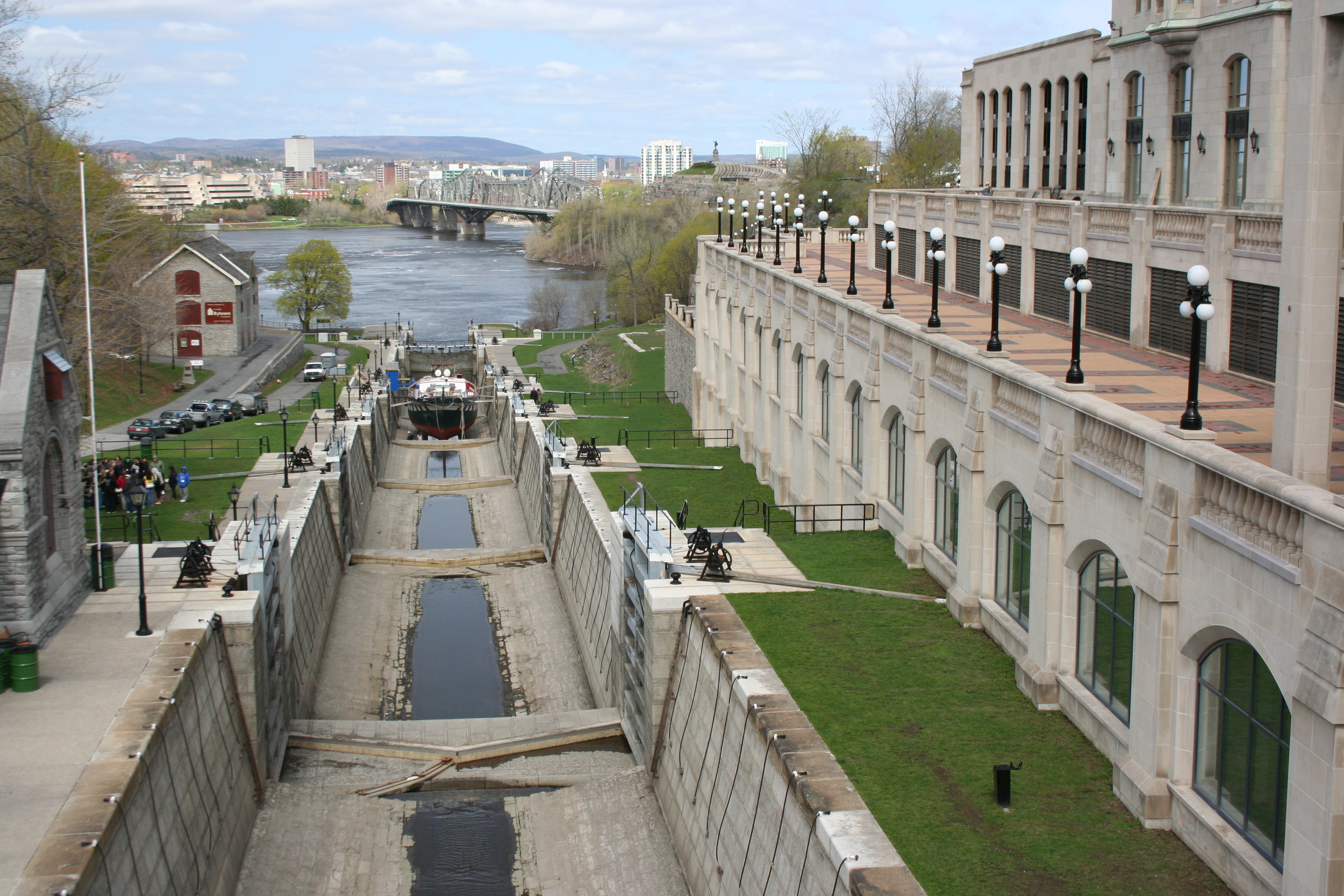
The Lockage Process
Locking through the Trent–Severn is straightforward in principle. Approach any lock at slow speed, well clear of the lock cut until the green light signals that entry is permitted. If a red light is showing, wait upstream (or downstream) of the approach wall in a position where your vessel is not blocking the channel for vessels exiting the lock.
- On the lockmaster's direction (usually a hand signal or VHF call), enter the lock chamber at idle. Keep crew and passengers seated or braced — do not stand at the bow without a handhold.
- Deckhand secures bow and stern lines to the floating guide cables or bollards, depending on lock design. Do not tie off to anything fixed in a lock — the water level is about to change significantly. Use lines with a round turn and an easily-released hitch.
- Engines off once secured, unless the lockmaster instructs otherwise. Leave the engine in gear at idle is acceptable at some locks with strong inflow turbulence.
- Passengers remain on the vessel. Lock walls are not pedestrian areas except at designated visitor facilities.
- On completion of lockage, wait for the green light or lockmaster signal before exiting. Exiting without signal can conflict with vessels from the other direction.
Lock Fees
Parks Canada charges lockage fees for transiting recreational vessels. Fees are per vessel per lock, with multi-day and full-transit passes available. As of the 2025 season, fees for a vessel under 12 metres were approximately $17 CAD per lock, with a transit pass covering unlimited lockages for a set period available for roughly $350 CAD. Fees increase for vessels over 12 metres. Passes can be purchased at the first lock or in advance through Parks Canada's reservation system.
Parks Canada's reservation system allows pre-booking at specific locks during peak season. Booking is not mandatory, but it guarantees a lockage slot during the busiest weekends in July and August on the Kirkfield and Peterborough reach. Unbooked vessels are accommodated on a first-come basis after booked reservations are processed.
Water Levels and Navigation Markers
The Trent–Severn is managed to maintain target water levels in each lake and river section for recreational boating, water supply, and hydroelectric generation. In years with unusually high spring runoff, some sections may experience elevated levels that push boating season back slightly and increase current in river sections. Drought conditions have the opposite effect — shallow sections near Port Severn on the lower Severn River and in some lake narrows can become problematic for deeper-draft vessels.
Canadian navigation buoy conventions: red buoys mark the starboard side when heading upstream (toward the head of navigation). Green buoys mark the port side heading upstream. On the Trent–Severn, "upstream" is defined as east-to-west from Lake Ontario toward Georgian Bay. Some buoys are numbered with "R" and "G" prefixes on charts.
Speed Restrictions
The federal speed limit in all Canadian inland waters near shore is 10 km/h within 30 metres of shore. Several sections of the Trent–Severn have posted additional speed restrictions. The entire waterway within lock cuts and approach channels is no-wake. High-speed operation on the open lake sections — Balsam Lake, Cameron Lake, and the Kawartha Lakes — is not restricted beyond the 30-metre rule, though local bylaw enforcement varies by municipality.
Fuel and Services Along the Route
Marine fuel is available at several points along the system, but not at every lock. The major service points include Trenton, Campbellford, Peterborough, Bobcaygeon, Fenelon Falls, Lindsay (off the main channel via the Scugog River), and Orillia. Carrying additional fuel capacity or planning refuelling stops carefully is prudent for the sections between Kirkfield and Port Severn, which are more thinly served.
Most towns adjacent to the waterway have grocery stores within reasonable walking distance of the public docks. Parks Canada provides free tie-up at lock facility walls overnight in most locations.
Charts and Navigation Resources
The Canadian Hydrographic Service publishes paper and digital charts covering the Trent–Severn Waterway. Charts 2021 through 2029 cover the system from Trenton to Port Severn at a scale adequate for navigation. The CHS's charts catalogue is the authoritative source for current editions. The Parks Canada guide to the Trent–Severn is a useful supplement for lock information but is not a substitute for current navigational charts.
← Related: Transport Canada Safety Equipment Requirements for Pleasure Craft